
- Start >
- Rivers >
- Waterlevel >
- Naab - Regen >
- Lorenzreuth >
- Chart of year

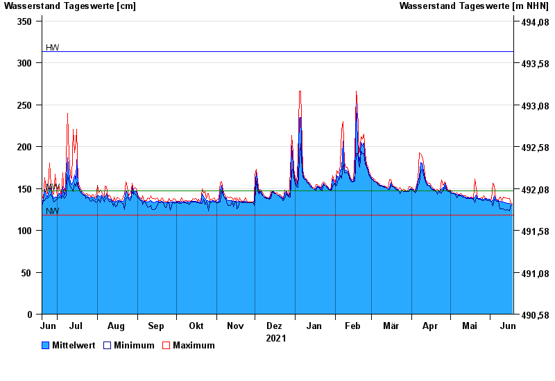
Chart of year Lorenzreuth / Röslau
Waterlevel from 19.06.2021 to 18.06.2022
| Date | Mean value [cm] | Maximum [cm] | Minimum [cm] |
|---|---|---|---|
| 18.06.2022 | 131 | 132 | 131 |
| 17.06.2022 | 131 | 132 | 131 |
| 16.06.2022 | 132 | 138 | 123 |
| 15.06.2022 | 132 | 138 | 124 |
| 14.06.2022 | 132 | 138 | 125 |
| 13.06.2022 | 133 | 139 | 124 |
| 12.06.2022 | 133 | 139 | 125 |
© Bayerisches Landesamt für Umwelt 2024