
- Start >
- Rivers >
- Waterlevel >
- Naab - Regen >
- Lorenzreuth >
- Chart of month

Chart of month Lorenzreuth / Röslau
Waterlevel from 01.04.2024 to 25.04.2024
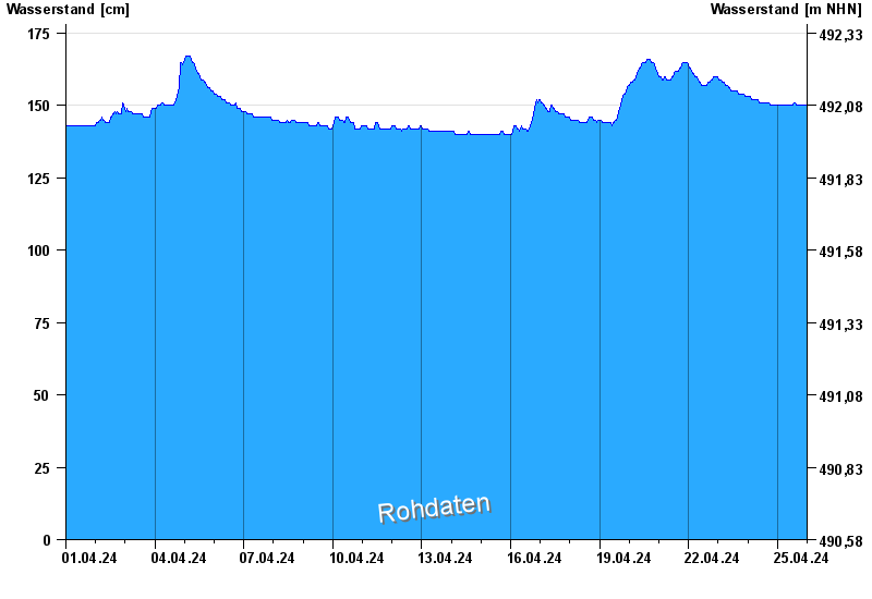
- Hochwassergefahrenfläche HQhäufig 290 cm
| Date | Waterlevel [cm] |
|---|---|
| 25.04.2024 14:15 | 151 |
| 25.04.2024 14:00 | 151 |
| 25.04.2024 13:45 | 151 |
| 25.04.2024 13:30 | 151 |
| 25.04.2024 13:15 | 151 |
| 25.04.2024 13:00 | 150 |
| 25.04.2024 12:45 | 150 |
© Bayerisches Landesamt für Umwelt 2024