
- Start >
- Rivers >
- Waterlevel >
- Naab - Regen >
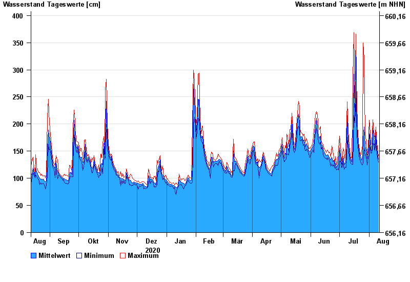
- Kempten >
- Chart of year

Chart of year Kempten / Iller
Waterlevel from 12.08.2020 to 11.08.2021
- 23.08.2005 Wasserstand: 646 cm
- 22.05.1999 Wasserstand: 631 cm
- 12.08.2002 Wasserstand: 555 cm
- 10.08.1970 Wasserstand: 542 cm
- 02.06.2013 Wasserstand: 535 cm
| Date | Mean value [cm] | Maximum [cm] | Minimum [cm] |
|---|---|---|---|
| 11.08.2021 | 135 | 141 | 129 |
| 10.08.2021 | 146 | 156 | 138 |
| 09.08.2021 | 164 | 176 | 153 |
| 08.08.2021 | 186 | 195 | 172 |
| 07.08.2021 | 157 | 172 | 150 |
| 06.08.2021 | 175 | 187 | 161 |
| 05.08.2021 | 193 | 208 | 164 |
© Bayerisches Landesamt für Umwelt 2024