
- Start >
- Rivers >
- Waterlevel >
- Naab - Regen >
- Kempten >
- Chart of year

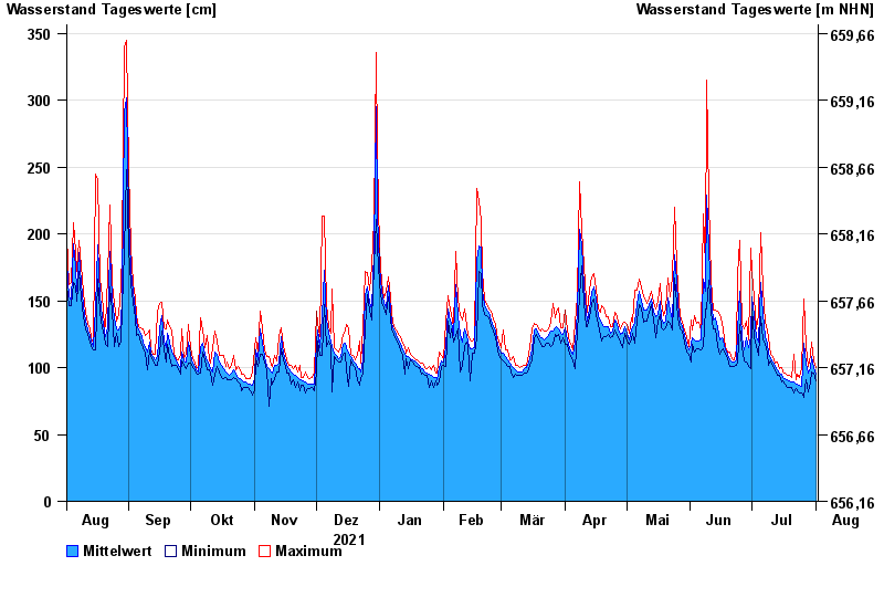
Chart of year Kempten / Iller
Waterlevel from 02.08.2021 to 01.08.2022
- 23.08.2005 Wasserstand: 646 cm
- 22.05.1999 Wasserstand: 631 cm
- 12.08.2002 Wasserstand: 555 cm
- 10.08.1970 Wasserstand: 542 cm
- 02.06.2013 Wasserstand: 535 cm
| Date | Mean value [cm] | Maximum [cm] | Minimum [cm] |
|---|---|---|---|
| 01.08.2022 | 95 | 100 | 90 |
| 31.07.2022 | 100 | 105 | 96 |
| 30.07.2022 | 108 | 119 | 97 |
| 29.07.2022 | 99 | 109 | 89 |
| 28.07.2022 | 96 | 101 | 82 |
| 27.07.2022 | 103 | 116 | 91 |
| 26.07.2022 | 118 | 151 | 78 |
© Bayerisches Landesamt für Umwelt 2024