
- Start >
- Rivers >
- Waterlevel >
- Naab - Regen >
- Kempten >
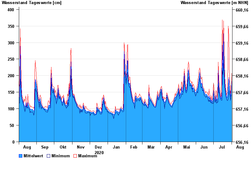
- Chart of year

Chart of year Kempten / Iller
Waterlevel from 02.08.2020 to 01.08.2021
- 23.08.2005 Wasserstand: 646 cm
- 22.05.1999 Wasserstand: 631 cm
- 12.08.2002 Wasserstand: 555 cm
- 10.08.1970 Wasserstand: 542 cm
- 02.06.2013 Wasserstand: 535 cm
| Date | Mean value [cm] | Maximum [cm] | Minimum [cm] |
|---|---|---|---|
| 01.08.2021 | 182 | 207 | 142 |
| 31.07.2021 | 147 | 158 | 138 |
| 30.07.2021 | 136 | 143 | 125 |
| 29.07.2021 | 151 | 169 | 140 |
| 28.07.2021 | 160 | 182 | 142 |
| 27.07.2021 | 195 | 320 | 156 |
| 26.07.2021 | 173 | 350 | 129 |
© Bayerisches Landesamt für Umwelt 2024