
- Start >
- Rivers >
- Waterlevel >
- Naab - Regen >
- Kempten >
- Chart of month

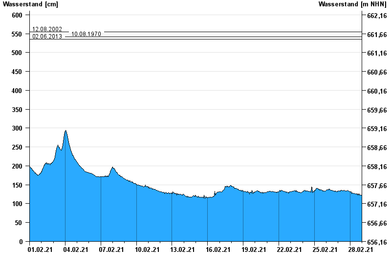
Chart of month Kempten / Iller
Waterlevel from 01.02.2021 to 28.02.2021
- 23.08.2005 Wasserstand: 646 cm
- 22.05.1999 Wasserstand: 631 cm
- 12.08.2002 Wasserstand: 555 cm
- 10.08.1970 Wasserstand: 542 cm
- 02.06.2013 Wasserstand: 535 cm
| Date | Waterlevel [cm] |
|---|---|
| 28.02.2021 23:45 | 122 |
| 28.02.2021 23:30 | 122 |
| 28.02.2021 23:15 | 122 |
| 28.02.2021 23:00 | 121 |
| 28.02.2021 22:45 | 121 |
| 28.02.2021 22:30 | 121 |
| 28.02.2021 22:15 | 122 |
© Bayerisches Landesamt für Umwelt 2024