
- Start >
- Rivers >
- Waterlevel >
- Naab - Regen >
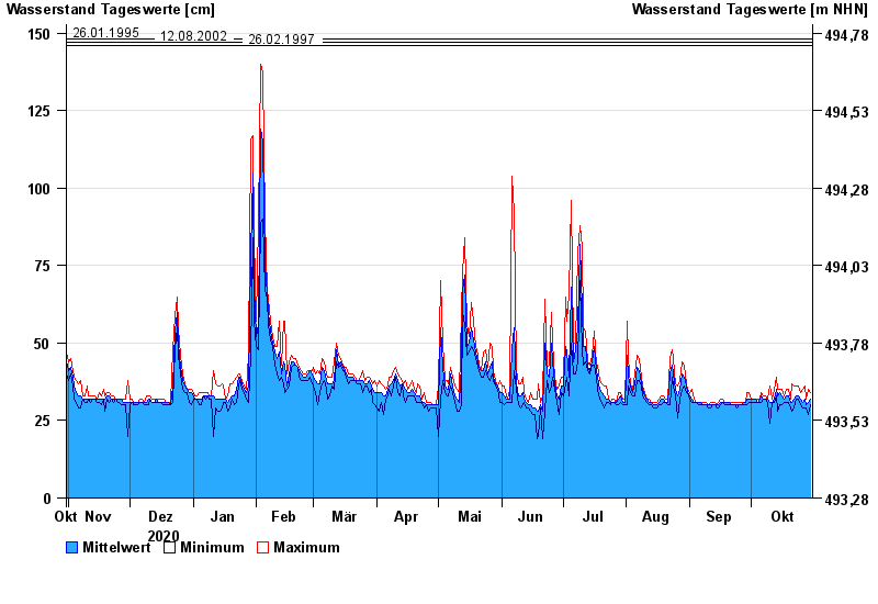
- Höll >
- Chart of year

Chart of year Höll / Schwarzach
Waterlevel from 31.10.2020 to 30.10.2021
- 02.07.1987 Wasserstand: 163 cm
- 21.12.1993 Wasserstand: 154 cm
- 26.01.1995 Wasserstand: 148 cm
- 12.08.2002 Wasserstand: 147 cm
- 26.02.1997 Wasserstand: 146 cm
| Date | Mean value [cm] | Maximum [cm] | Minimum [cm] |
|---|---|---|---|
| 30.10.2021 | 32 | 34 | 30 |
| 29.10.2021 | 31 | 35 | 27 |
| 28.10.2021 | 30 | 32 | 29 |
| 27.10.2021 | 32 | 36 | 29 |
| 26.10.2021 | 31 | 35 | 29 |
| 25.10.2021 | 32 | 34 | 30 |
| 24.10.2021 | 33 | 36 | 32 |
© Bayerisches Landesamt für Umwelt 2024