
- Start >
- Rivers >
- Waterlevel >
- Naab - Regen >
- Geisleithen >
- Chart of year

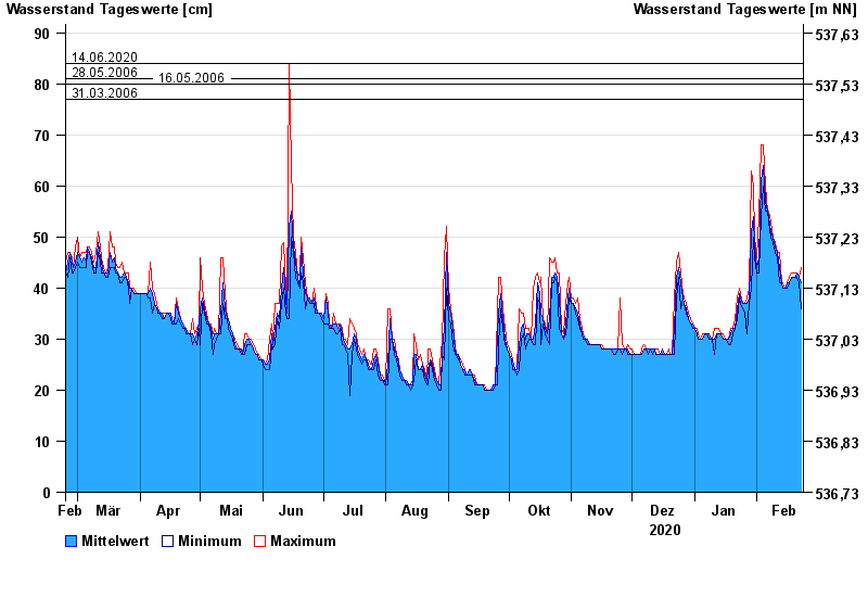
Chart of year Geisleithen / Geisbach
Waterlevel from 24.02.2020 to 23.02.2021
- 05.06.2011 Wasserstand: 94 cm
- 14.06.2020 Wasserstand: 84 cm
- 28.05.2006 Wasserstand: 81 cm
- 16.05.2006 Wasserstand: 80 cm
- 31.03.2006 Wasserstand: 77 cm
| Date | Mean value [cm] | Maximum [cm] | Minimum [cm] |
|---|---|---|---|
| 23.02.2021 | 41 | 44 | 36 |
| 22.02.2021 | 42 | 42 | 41 |
| 21.02.2021 | 43 | 43 | 42 |
| 20.02.2021 | 42 | 43 | 42 |
| 19.02.2021 | 42 | 43 | 42 |
| 18.02.2021 | 42 | 43 | 42 |
| 17.02.2021 | 41 | 42 | 41 |
© Bayerisches Landesamt für Umwelt 2024