
- Start >
- Rivers >
- Waterlevel >
- Naab - Regen >
- Fronhof >
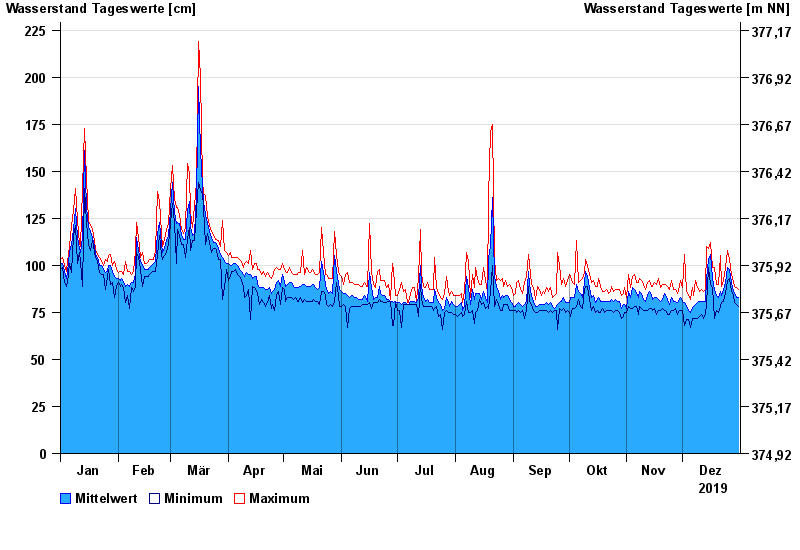
- Chart of year

Chart of year Fronhof / Murach
Waterlevel from 01.01.2019 to 31.12.2019
- 03.06.2013 Wasserstand: 312 cm
- 26.01.1995 Wasserstand: 304 cm
- 13.02.2005 Wasserstand: 301 cm
- 21.12.1993 Wasserstand: 301 cm
- 13.01.2011 Wasserstand: 297 cm
| Date | Mean value [cm] | Maximum [cm] | Minimum [cm] |
|---|---|---|---|
| 31.12.2019 | 83 | 87 | 78 |
| 30.12.2019 | 83 | 88 | 79 |
| 29.12.2019 | 85 | 89 | 80 |
| 28.12.2019 | 86 | 91 | 84 |
| 27.12.2019 | 91 | 95 | 86 |
| 26.12.2019 | 98 | 103 | 93 |
| 25.12.2019 | 99 | 108 | 92 |
© Bayerisches Landesamt für Umwelt 2024