
- Start >
- Rivers >
- Waterlevel >
- Naab - Regen >
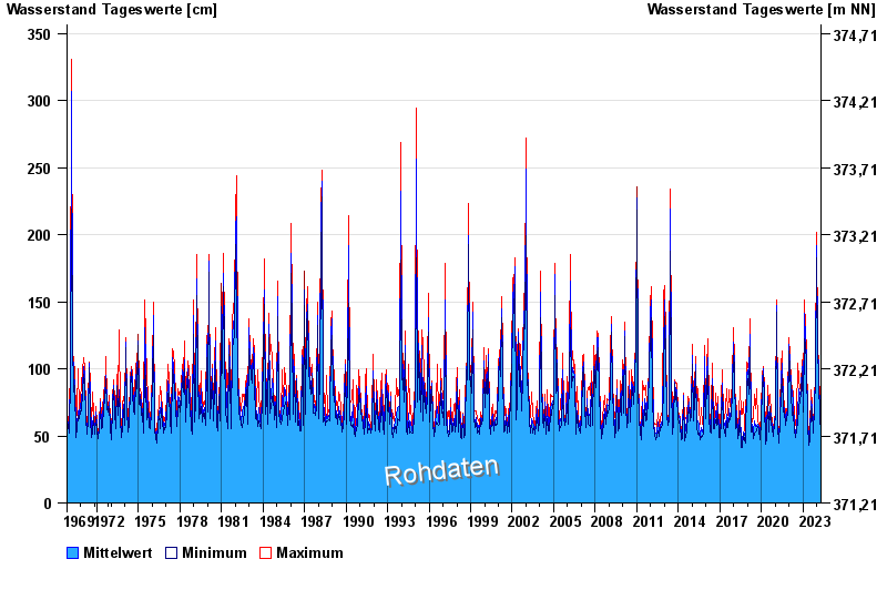
- Amberg >
- Chart of total period

Chart of total period Amberg / Vils
Waterlevel from 01.11.1969 to 24.04.2024
| Date | Mean value [cm] | Maximum [cm] | Minimum [cm] |
|---|---|---|---|
| 24.04.2024 | 64 | 65 | 63 |
| 23.04.2024 | 68 | 69 | 65 |
| 22.04.2024 | 73 | 76 | 67 |
| 21.04.2024 | 72 | 76 | 68 |
| 20.04.2024 | 69 | 72 | 64 |
| 19.04.2024 | 59 | 67 | 55 |
| 18.04.2024 | 58 | 60 | 56 |
© Bayerisches Landesamt für Umwelt 2024