
- Start >
- Rivers >
- Waterlevel >
- Unterer Main >
- Wüstenzell >
- Chart of year

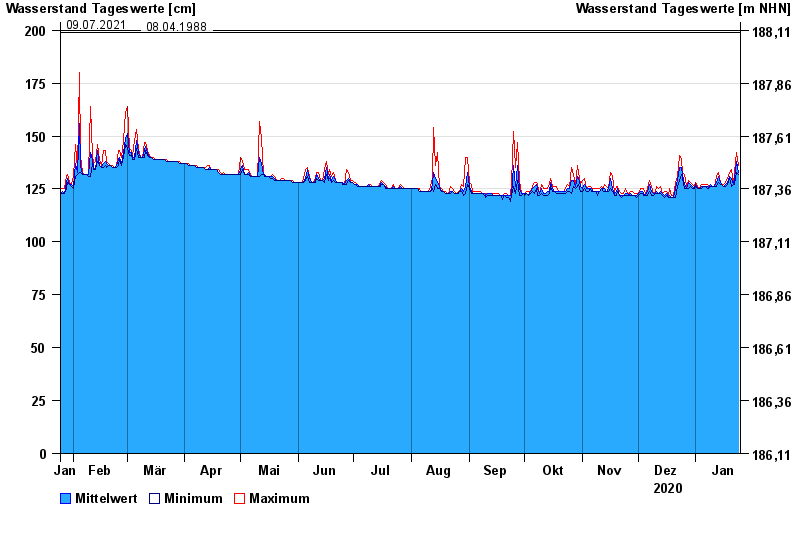
Chart of year Wüstenzell / Aalbach
Waterlevel from 25.01.2020 to 24.01.2021
- 20.06.1992 Wasserstand: 260 cm
- 04.05.2017 Wasserstand: 234 cm
- 26.01.1995 Wasserstand: 218 cm
- 09.07.2021 Wasserstand: 200 cm
- 08.04.1988 Wasserstand: 199 cm
| Date | Mean value [cm] | Maximum [cm] | Minimum [cm] |
|---|---|---|---|
| 24.01.2021 | 133 | 136 | 132 |
| 23.01.2021 | 138 | 142 | 133 |
| 22.01.2021 | 130 | 133 | 127 |
| 21.01.2021 | 127 | 127 | 127 |
| 20.01.2021 | 130 | 134 | 126 |
| 19.01.2021 | 131 | 133 | 130 |
| 18.01.2021 | 128 | 130 | 127 |
© Bayerisches Landesamt für Umwelt 2024