
- Start >
- Rivers >
- Waterlevel >
- Unterer Main >
- Wolfsmünster >
- Chart of year

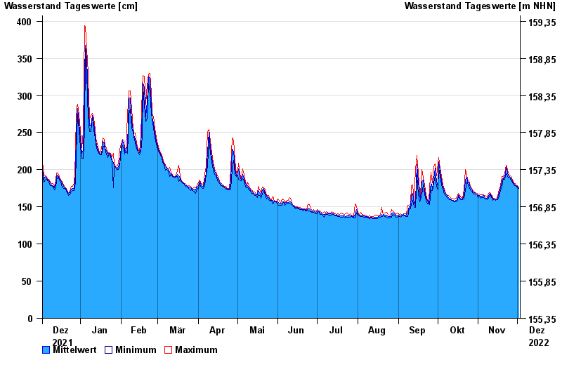
Chart of year Wolfsmünster / Fränkische Saale
Waterlevel from 03.12.2021 to 02.12.2022
- 03.01.2003 Wasserstand: 653 cm
- 14.01.2011 Wasserstand: 614 cm
- 24.01.1995 Wasserstand: 585 cm
- 08.02.1984 Wasserstand: 579 cm
- 06.01.1982 Wasserstand: 575 cm
| Date | Mean value [cm] | Maximum [cm] | Minimum [cm] |
|---|---|---|---|
| 02.12.2022 | 176 | 177 | 175 |
| 01.12.2022 | 178 | 179 | 176 |
| 30.11.2022 | 179 | 180 | 178 |
| 29.11.2022 | 180 | 181 | 179 |
| 28.11.2022 | 181 | 182 | 180 |
| 27.11.2022 | 184 | 186 | 182 |
| 26.11.2022 | 189 | 191 | 186 |
© Bayerisches Landesamt für Umwelt 2024