
- Start >
- Rivers >
- Waterlevel >
- Unterer Main >
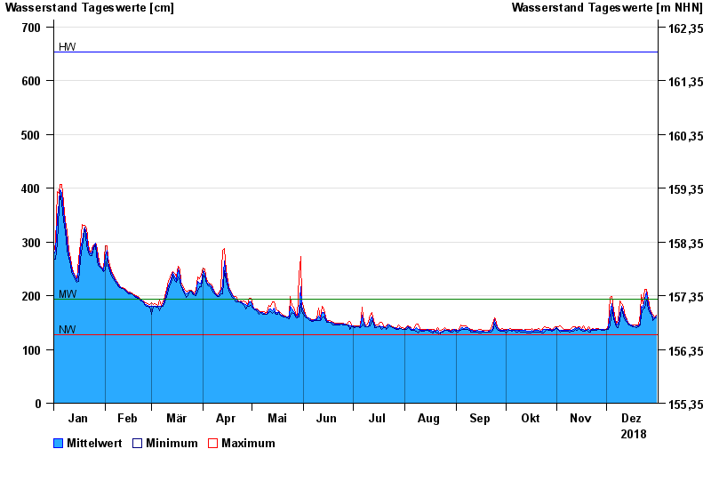
- Wolfsmünster >
- Chart of year

Chart of year Wolfsmünster / Fränkische Saale
Waterlevel from 01.01.2018 to 31.12.2018
| Date | Mean value [cm] | Maximum [cm] | Minimum [cm] |
|---|---|---|---|
| 31.12.2018 | 162 | 164 | 159 |
| 30.12.2018 | 159 | 161 | 157 |
| 29.12.2018 | 161 | 166 | 154 |
| 28.12.2018 | 165 | 167 | 163 |
| 27.12.2018 | 171 | 175 | 167 |
| 26.12.2018 | 183 | 193 | 174 |
| 25.12.2018 | 206 | 212 | 193 |
© Bayerisches Landesamt für Umwelt 2024