
- Start >
- Rivers >
- Waterlevel >
- Unterer Main >
- Untermerzbach >
- Chart of month

Chart of month Untermerzbach / Merzbach
Waterlevel from 26.01.2021 to 25.02.2021
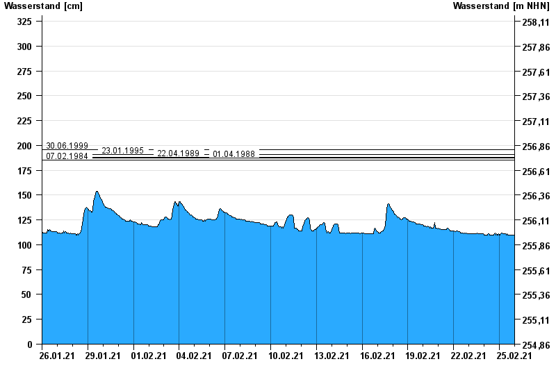
- 30.06.1999 Wasserstand: 196 cm
- 23.01.1995 Wasserstand: 191 cm
- 22.04.1989 Wasserstand: 188 cm
- 01.04.1988 Wasserstand: 187 cm
- 07.02.1984 Wasserstand: 185 cm
| Date | Waterlevel [cm] |
|---|---|
| 25.02.2021 23:45 | 109 |
| 25.02.2021 23:30 | 110 |
| 25.02.2021 23:15 | 110 |
| 25.02.2021 23:00 | 109 |
| 25.02.2021 22:45 | 110 |
| 25.02.2021 22:30 | 109 |
| 25.02.2021 22:15 | 110 |
© Bayerisches Landesamt für Umwelt 2024