
- Start >
- Rivers >
- Waterlevel >
- Unterer Main >
- Salz >
- Chart of year

Chart of year Salz / Fränkische Saale
Waterlevel from 01.01.2017 to 31.12.2017
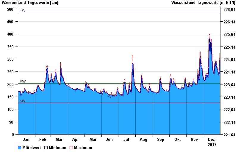
| Date | Mean value [cm] | Maximum [cm] | Minimum [cm] |
|---|---|---|---|
| 31.12.2017 | 297 | 322 | 254 |
| 30.12.2017 | 240 | 254 | 237 |
| 29.12.2017 | 241 | 246 | 238 |
| 28.12.2017 | 249 | 252 | 246 |
| 27.12.2017 | 257 | 262 | 252 |
| 26.12.2017 | 262 | 269 | 258 |
| 25.12.2017 | 280 | 290 | 269 |
© Bayerisches Landesamt für Umwelt 2024