
- Start >
- Rivers >
- Waterlevel >
- Unterer Main >
- Salz >
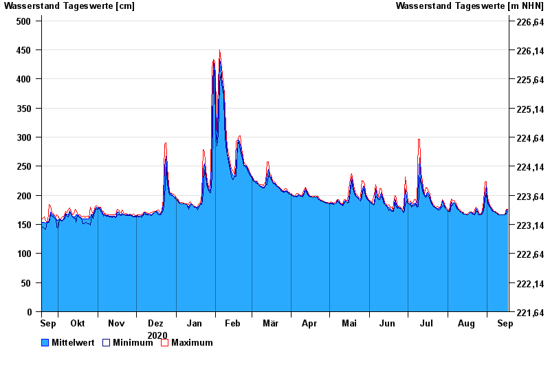
- Chart of year

Chart of year Salz / Fränkische Saale
Waterlevel from 18.09.2020 to 17.09.2021
| Date | Mean value [cm] | Maximum [cm] | Minimum [cm] |
|---|---|---|---|
| 17.09.2021 | 175 | 176 | 173 |
| 16.09.2021 | 174 | 176 | 168 |
| 15.09.2021 | 166 | 168 | 166 |
| 14.09.2021 | 166 | 167 | 166 |
| 13.09.2021 | 167 | 167 | 167 |
| 12.09.2021 | 167 | 167 | 167 |
| 11.09.2021 | 167 | 167 | 167 |
© Bayerisches Landesamt für Umwelt 2024