
- Start >
- Rivers >
- Waterlevel >
- Unterer Main >
- Salz >
- Chart of year

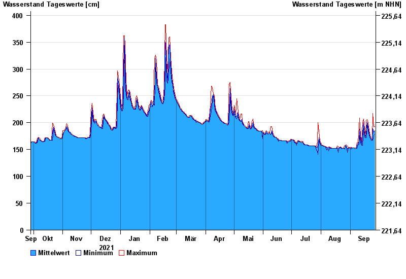
Chart of year Salz / Fränkische Saale
Waterlevel from 28.09.2021 to 27.09.2022
- 03.01.2003 Wasserstand: 488 cm
- 14.01.2011 Wasserstand: 470 cm
- 06.01.1982 Wasserstand: 466 cm
- 23.01.1995 Wasserstand: 465 cm
- 07.02.1984 Wasserstand: 463 cm
| Date | Mean value [cm] | Maximum [cm] | Minimum [cm] |
|---|---|---|---|
| 27.09.2022 | 185 | 193 | 179 |
| 26.09.2022 | 182 | 192 | 177 |
| 25.09.2022 | 189 | 217 | 167 |
| 24.09.2022 | 167 | 168 | 167 |
| 23.09.2022 | 168 | 171 | 167 |
| 22.09.2022 | 173 | 177 | 171 |
| 21.09.2022 | 180 | 185 | 177 |
© Bayerisches Landesamt für Umwelt 2024