
- Start >
- Rivers >
- Waterlevel >
- Unterer Main >
- Salz >
- Chart of year

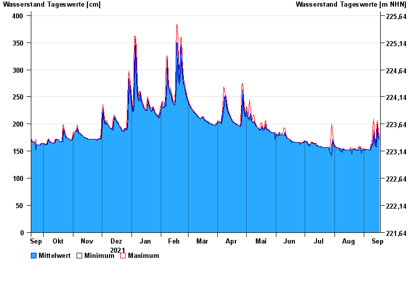
Chart of year Salz / Fränkische Saale
Waterlevel from 18.09.2021 to 17.09.2022
- 03.01.2003 Wasserstand: 488 cm
- 14.01.2011 Wasserstand: 470 cm
- 06.01.1982 Wasserstand: 466 cm
- 23.01.1995 Wasserstand: 465 cm
- 07.02.1984 Wasserstand: 463 cm
| Date | Mean value [cm] | Maximum [cm] | Minimum [cm] |
|---|---|---|---|
| 17.09.2022 | 174 | 177 | 172 |
| 16.09.2022 | 179 | 189 | 173 |
| 15.09.2022 | 200 | 207 | 189 |
| 14.09.2022 | 181 | 200 | 158 |
| 13.09.2022 | 160 | 163 | 158 |
| 12.09.2022 | 169 | 177 | 163 |
| 11.09.2022 | 188 | 209 | 177 |
© Bayerisches Landesamt für Umwelt 2024