
- Start >
- Rivers >
- Waterlevel >
- Unterer Main >
- Partenstein >
- Chart of year

Chart of year Partenstein / Lohr
Waterlevel from 27.06.2022 to 26.06.2023
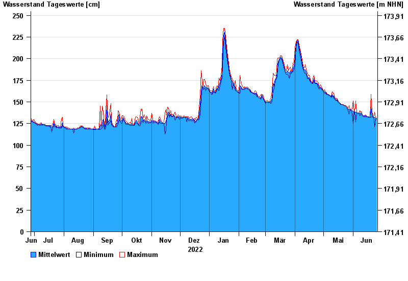
- Hochwassergefahrenfläche HQ100 310 cm
| Date | Mean value [cm] | Maximum [cm] | Minimum [cm] |
|---|---|---|---|
| 26.06.2023 | 131 | 131 | 130 |
| 25.06.2023 | 131 | 132 | 130 |
| 24.06.2023 | 132 | 138 | 121 |
| 23.06.2023 | 132 | 134 | 130 |
| 22.06.2023 | 132 | 133 | 132 |
| 21.06.2023 | 135 | 139 | 133 |
| 20.06.2023 | 144 | 159 | 132 |
© Bayerisches Landesamt für Umwelt 2024