
- Start >
- Rivers >
- Waterlevel >
- Unterer Main >
- Lohr >
- Chart of year

Chart of year Lohr / Baunach
Waterlevel from 01.01.2024 to 23.04.2024
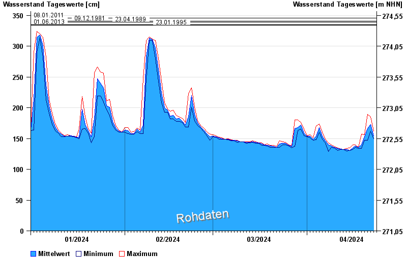
- 08.01.2011 Wasserstand: 346 cm
- 09.12.1981 Wasserstand: 341 cm
- 23.04.1989 Wasserstand: 339 cm
- 01.06.2013 Wasserstand: 335 cm
- 23.01.1995 Wasserstand: 334 cm
| Date | Mean value [cm] | Maximum [cm] | Minimum [cm] |
|---|---|---|---|
| 23.04.2024 | 155 | 162 | 150 |
| 22.04.2024 | 173 | 185 | 162 |
| 21.04.2024 | 166 | 189 | 147 |
| 20.04.2024 | 153 | 156 | 147 |
| 19.04.2024 | 140 | 157 | 134 |
| 18.04.2024 | 136 | 136 | 134 |
| 17.04.2024 | 138 | 140 | 136 |
© Bayerisches Landesamt für Umwelt 2024