
- Start >
- Rivers >
- Waterlevel >
- Unterer Main >
- Gemünden Lachsfangsteg >
- Chart of year

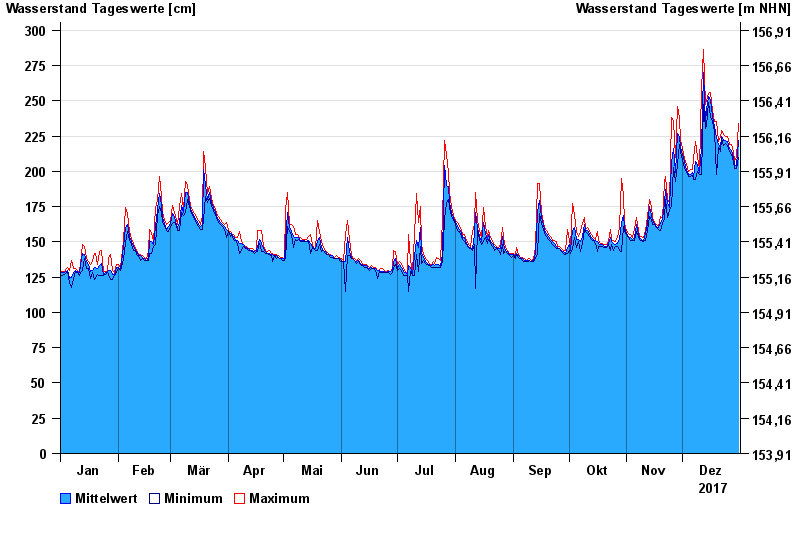
Chart of year Gemünden Lachsfangsteg / Sinn
Waterlevel from 01.01.2017 to 31.12.2017
- 03.01.2003 Wasserstand: 389 cm
- 24.12.1967 Wasserstand: 386 cm
- 23.02.1970 Wasserstand: 373 cm
- 14.01.2011 Wasserstand: 369 cm
- 23.01.1995 Wasserstand: 362 cm
| Date | Mean value [cm] | Maximum [cm] | Minimum [cm] |
|---|---|---|---|
| 31.12.2017 | 222 | 234 | 210 |
| 30.12.2017 | 204 | 210 | 202 |
| 29.12.2017 | 205 | 208 | 202 |
| 28.12.2017 | 210 | 213 | 207 |
| 27.12.2017 | 215 | 219 | 212 |
| 26.12.2017 | 216 | 219 | 214 |
| 25.12.2017 | 221 | 225 | 218 |
© Bayerisches Landesamt für Umwelt 2024