
- Start >
- Rivers >
- Waterlevel >
- Unterer Main >
- Gemünden Lachsfangsteg >
- Chart of year

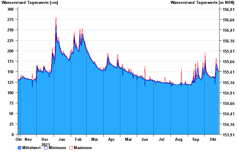
Chart of year Gemünden Lachsfangsteg / Sinn
Waterlevel from 28.10.2021 to 27.10.2022
- 03.01.2003 Wasserstand: 389 cm
- 24.12.1967 Wasserstand: 386 cm
- 23.02.1970 Wasserstand: 373 cm
- 14.01.2011 Wasserstand: 369 cm
- 23.01.1995 Wasserstand: 362 cm
| Date | Mean value [cm] | Maximum [cm] | Minimum [cm] |
|---|---|---|---|
| 27.10.2022 | 150 | 151 | 149 |
| 26.10.2022 | 152 | 154 | 151 |
| 25.10.2022 | 156 | 160 | 154 |
| 24.10.2022 | 161 | 164 | 156 |
| 23.10.2022 | 163 | 173 | 156 |
| 22.10.2022 | 170 | 183 | 156 |
| 21.10.2022 | 141 | 156 | 136 |
© Bayerisches Landesamt für Umwelt 2024