
- Start >
- Rivers >
- Waterlevel >
- Unterer Main >
- Gemünden Lachsfangsteg >
- Chart of year

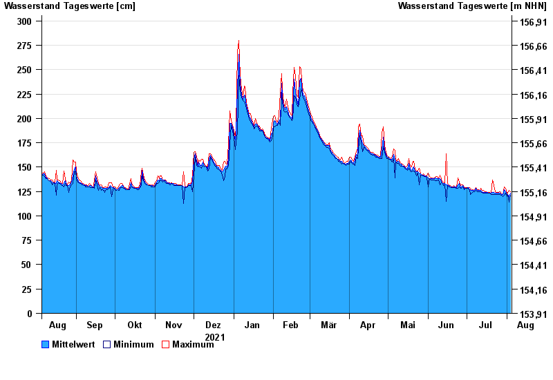
Chart of year Gemünden Lachsfangsteg / Sinn
Waterlevel from 05.08.2021 to 04.08.2022
- 03.01.2003 Wasserstand: 389 cm
- 24.12.1967 Wasserstand: 386 cm
- 23.02.1970 Wasserstand: 373 cm
- 14.01.2011 Wasserstand: 369 cm
- 23.01.1995 Wasserstand: 362 cm
| Date | Mean value [cm] | Maximum [cm] | Minimum [cm] |
|---|---|---|---|
| 04.08.2022 | 123 | 125 | 121 |
| 03.08.2022 | 120 | 126 | 114 |
| 02.08.2022 | 122 | 123 | 122 |
| 01.08.2022 | 122 | 123 | 120 |
| 31.07.2022 | 125 | 128 | 123 |
| 30.07.2022 | 127 | 130 | 121 |
| 29.07.2022 | 122 | 122 | 120 |
© Bayerisches Landesamt für Umwelt 2024