
- Start >
- Rivers >
- Waterlevel >
- Unterer Main >
- Gemünden Lachsfangsteg >
- Chart of year

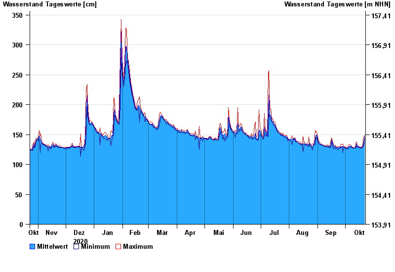
Chart of year Gemünden Lachsfangsteg / Sinn
Waterlevel from 23.10.2020 to 22.10.2021
- Hochwassergefahrenfläche HQ100 380 cm
| Date | Mean value [cm] | Maximum [cm] | Minimum [cm] |
|---|---|---|---|
| 22.10.2021 | 147 | 149 | 142 |
| 21.10.2021 | 136 | 145 | 131 |
| 20.10.2021 | 130 | 132 | 129 |
| 19.10.2021 | 128 | 129 | 127 |
| 18.10.2021 | 128 | 129 | 127 |
| 17.10.2021 | 128 | 129 | 128 |
| 16.10.2021 | 129 | 130 | 128 |
© Bayerisches Landesamt für Umwelt 2024