
- Start >
- Rivers >
- Waterlevel >
- Unterer Main >
- Donauwörth >
- Chart of year

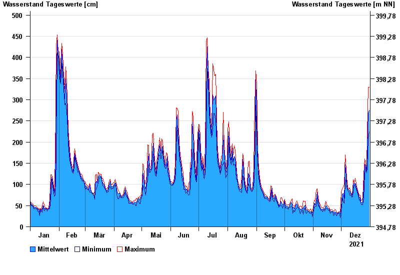
Chart of year Donauwörth / Donau
Waterlevel from 01.01.2021 to 31.12.2021
- 14.04.1994 Wasserstand: 577 cm
- 16.02.1990 Wasserstand: 553 cm
- 24.05.1999 Wasserstand: 552 cm
- 27.03.1988 Wasserstand: 544 cm
- 01.02.1982 Wasserstand: 543 cm
| Date | Mean value [cm] | Maximum [cm] | Minimum [cm] |
|---|---|---|---|
| 31.12.2021 | 275 | 329 | 225 |
| 30.12.2021 | 268 | 329 | 208 |
| 29.12.2021 | 189 | 221 | 140 |
| 28.12.2021 | 131 | 141 | 127 |
| 27.12.2021 | 144 | 146 | 141 |
| 26.12.2021 | 148 | 161 | 124 |
| 25.12.2021 | 97 | 124 | 68 |
© Bayerisches Landesamt für Umwelt 2024