
- Start >
- Rivers >
- Waterlevel >
- Unterer Main >
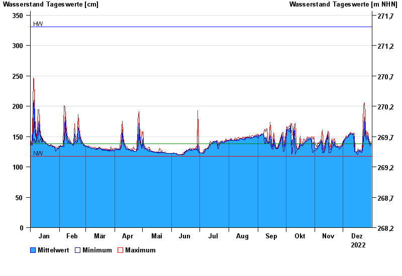
- Bad Königshofen im Grabfeld >
- Chart of year

Chart of year Bad Königshofen im Grabfeld / Fränkische Saale
Waterlevel from 01.01.2022 to 31.12.2022
note
Biberaktivität: Werte können durch Aufstau beeinflusst sein
| Date | Mean value [cm] | Maximum [cm] | Minimum [cm] |
|---|---|---|---|
| 31.12.2022 | 140 | 142 | 137 |
| 30.12.2022 | 137 | 139 | 134 |
| 29.12.2022 | 141 | 144 | 139 |
| 28.12.2022 | 145 | 148 | 144 |
| 27.12.2022 | 152 | 158 | 147 |
| 26.12.2022 | 147 | 151 | 144 |
| 25.12.2022 | 154 | 163 | 147 |
© Bayerisches Landesamt für Umwelt 2024