
- Start >
- Rivers >
- Waterlevel >
- Unterer Main >
- Bad Kissingen Golfplatz >
- Chart of year

Chart of year Bad Kissingen Golfplatz / Fränkische Saale
Waterlevel from 01.01.2021 to 31.12.2021
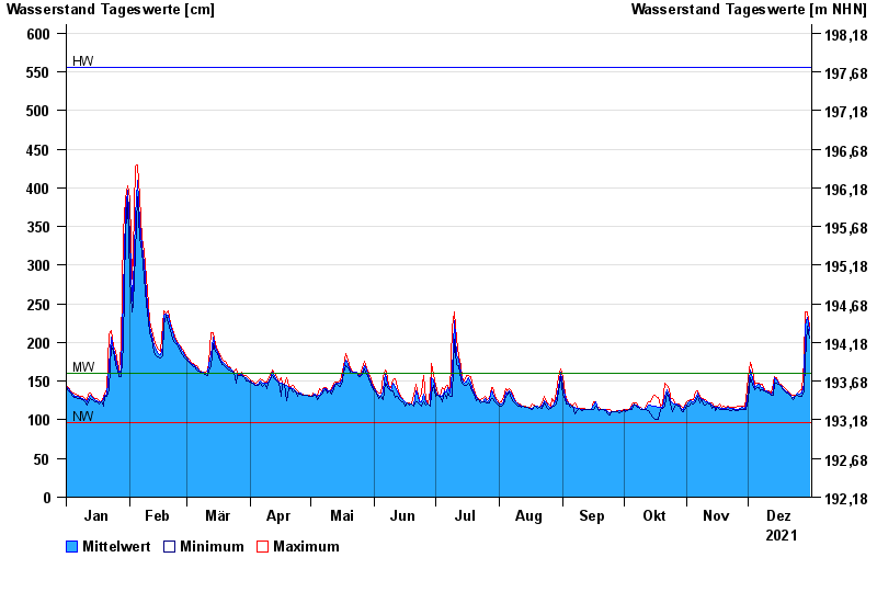
| Date | Mean value [cm] | Maximum [cm] | Minimum [cm] |
|---|---|---|---|
| 31.12.2021 | 216 | 221 | 205 |
| 30.12.2021 | 232 | 240 | 221 |
| 29.12.2021 | 223 | 240 | 176 |
| 28.12.2021 | 148 | 176 | 138 |
| 27.12.2021 | 134 | 139 | 131 |
| 26.12.2021 | 133 | 137 | 131 |
| 25.12.2021 | 135 | 135 | 132 |
© Bayerisches Landesamt für Umwelt 2024