
- Start >
- Rivers >
- Waterlevel >
- Unterer Main >
- Bad Kissingen Golfplatz >
- Chart of month

Chart of month Bad Kissingen Golfplatz / Fränkische Saale
Waterlevel from 05.12.2021 to 04.01.2022
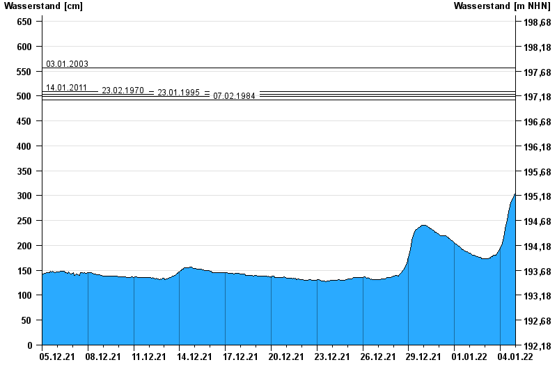
- 03.01.2003 Wasserstand: 556 cm
- 14.01.2011 Wasserstand: 509 cm
- 23.02.1970 Wasserstand: 503 cm
- 23.01.1995 Wasserstand: 499 cm
- 07.02.1984 Wasserstand: 492 cm
| Date | Waterlevel [cm] |
|---|---|
| 04.01.2022 23:45 | 304 |
| 04.01.2022 23:30 | 303 |
| 04.01.2022 23:15 | 303 |
| 04.01.2022 23:00 | 302 |
| 04.01.2022 22:45 | 302 |
| 04.01.2022 22:30 | 301 |
| 04.01.2022 22:15 | 301 |
© Bayerisches Landesamt für Umwelt 2024