
- Start >
- Rivers >
- Waterlevel >
- Unterer Main >
- Astheim >
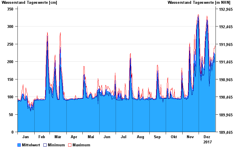
- Chart of year

Chart of year Astheim / Main
Waterlevel from 01.01.2017 to 31.12.2017
- 16.01.2011 Wasserstand: 665 cm
- 05.01.2003 Wasserstand: 663 cm
- 25.02.1970 Wasserstand: 627 cm
- 08.01.1982 Wasserstand: 624 cm
- 28.01.1995 Wasserstand: 623 cm
| Date | Mean value [cm] | Maximum [cm] | Minimum [cm] |
|---|---|---|---|
| 31.12.2017 | 220 | 245 | 197 |
| 30.12.2017 | 222 | 237 | 199 |
| 29.12.2017 | 226 | 238 | 216 |
| 28.12.2017 | 207 | 217 | 198 |
| 27.12.2017 | 205 | 212 | 199 |
| 26.12.2017 | 197 | 209 | 188 |
| 25.12.2017 | 187 | 201 | 173 |
© Bayerisches Landesamt für Umwelt 2024