
- Start >
- Rivers >
- Waterlevel >
- Unterer Main >
- Arnstein >
- Chart of year

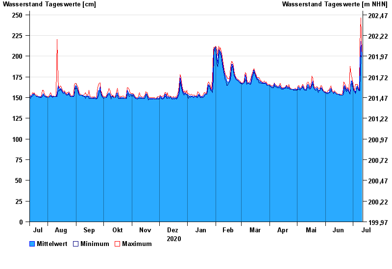
Chart of year Arnstein / Wern
Waterlevel from 12.07.2020 to 11.07.2021
- 03.07.2009 Wasserstand: 306 cm
- 26.01.1995 Wasserstand: 305 cm
- 01.06.2013 Wasserstand: 298 cm
- 06.01.1982 Wasserstand: 294 cm
- 10.01.2011 Wasserstand: 288 cm
| Date | Mean value [cm] | Maximum [cm] | Minimum [cm] |
|---|---|---|---|
| 11.07.2021 | 201 | 204 | 199 |
| 10.07.2021 | 218 | 246 | 201 |
| 09.07.2021 | 193 | 213 | 158 |
| 08.07.2021 | 159 | 159 | 158 |
| 07.07.2021 | 160 | 162 | 159 |
| 06.07.2021 | 164 | 166 | 162 |
| 05.07.2021 | 163 | 166 | 161 |
© Bayerisches Landesamt für Umwelt 2024