
- Start >
- Rivers >
- Waterlevel >
- Obere Donau >
- Weißenburg >
- Chart of year

Chart of year Weißenburg / Schwäbische Rezat
Waterlevel from 23.09.2021 to 22.09.2022
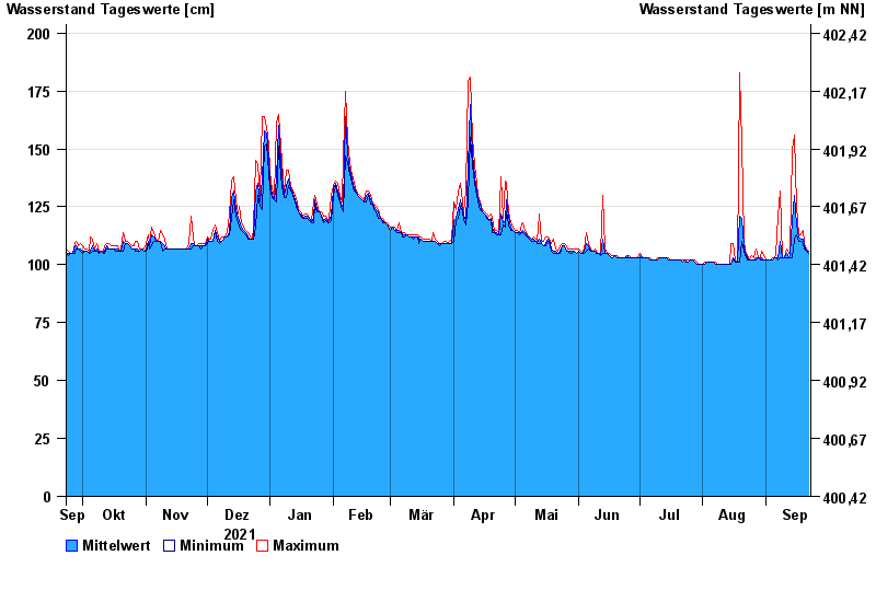
- Hochwassergefahrenfläche HQ100 290 cm
| Date | Mean value [cm] | Maximum [cm] | Minimum [cm] |
|---|---|---|---|
| 22.09.2022 | 106 | 106 | 105 |
| 21.09.2022 | 106 | 107 | 106 |
| 20.09.2022 | 108 | 109 | 107 |
| 19.09.2022 | 111 | 115 | 109 |
| 18.09.2022 | 111 | 113 | 110 |
| 17.09.2022 | 112 | 113 | 110 |
| 16.09.2022 | 117 | 125 | 113 |
© Bayerisches Landesamt für Umwelt 2024