
- Start >
- Rivers >
- Waterlevel >
- Obere Donau >
- Vohburg >
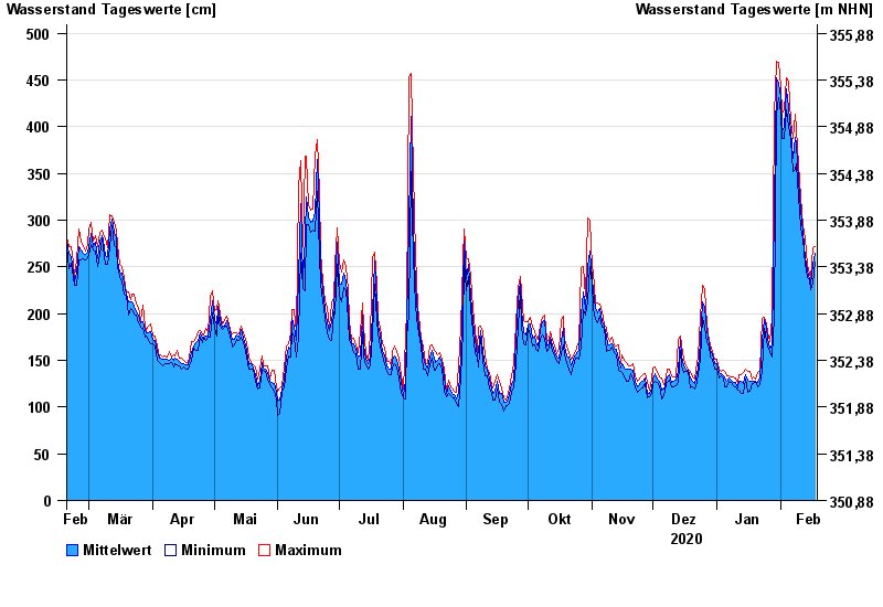
- Chart of year

Chart of year Vohburg / Donau
Waterlevel from 19.02.2020 to 18.02.2021
| Date | Mean value [cm] | Maximum [cm] | Minimum [cm] |
|---|---|---|---|
| 18.02.2021 | 265 | 272 | 255 |
| 17.02.2021 | 253 | 270 | 233 |
| 16.02.2021 | 231 | 238 | 226 |
| 15.02.2021 | 238 | 242 | 236 |
| 14.02.2021 | 246 | 253 | 239 |
| 13.02.2021 | 260 | 280 | 253 |
| 12.02.2021 | 287 | 294 | 280 |
© Bayerisches Landesamt für Umwelt 2024