
- Start >
- Rivers >
- Waterlevel >
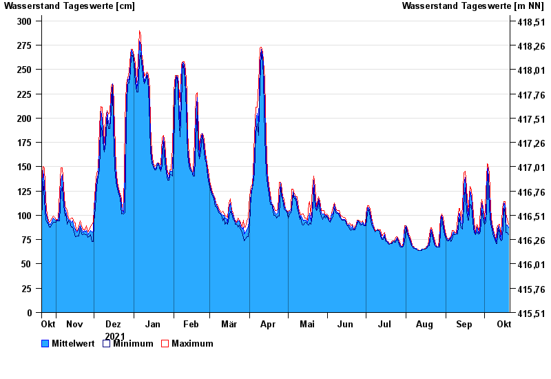
- Obere Donau >
- Thann >
- Chart of year

Chart of year Thann / Altmühl
Waterlevel from 21.10.2021 to 20.10.2022
| Date | Mean value [cm] | Maximum [cm] | Minimum [cm] |
|---|---|---|---|
| 20.10.2022 | 87 | 91 | 80 |
| 19.10.2022 | 90 | 96 | 82 |
| 18.10.2022 | 91 | 102 | 82 |
| 17.10.2022 | 110 | 114 | 102 |
| 16.10.2022 | 113 | 114 | 108 |
| 15.10.2022 | 92 | 108 | 75 |
| 14.10.2022 | 75 | 77 | 74 |
© Bayerisches Landesamt für Umwelt 2024