
- Start >
- Rivers >
- Waterlevel >
- Obere Donau >
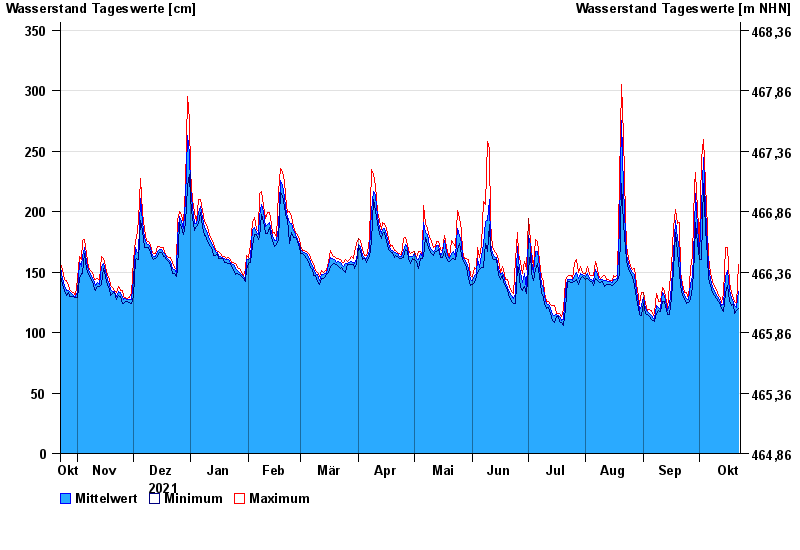
- Neu Ulm, Bad Held >
- Chart of year

Chart of year Neu Ulm, Bad Held / Donau
Waterlevel from 23.10.2021 to 22.10.2022
ACHTUNG!
Pegel durch außerordentlichen Kraftwerksbetrieb beeinflusst.
- 23.05.1999 Wasserstand: 571 cm
- 24.08.2005 Wasserstand: 543 cm
- 03.06.2013 Wasserstand: 502 cm
- 16.02.1990 Wasserstand: 471 cm
- 13.08.2002 Wasserstand: 469 cm
| Date | Mean value [cm] | Maximum [cm] | Minimum [cm] |
|---|---|---|---|
| 22.10.2022 | 134 | 156 | 120 |
| 21.10.2022 | 121 | 124 | 118 |
| 20.10.2022 | 122 | 126 | 116 |
| 19.10.2022 | 125 | 128 | 123 |
| 18.10.2022 | 129 | 133 | 122 |
| 17.10.2022 | 135 | 141 | 126 |
| 16.10.2022 | 151 | 170 | 139 |
© Bayerisches Landesamt für Umwelt 2024