
- Start >
- Rivers >
- Waterlevel >
- Obere Donau >
- Mitteldachstetten >
- Chart of year

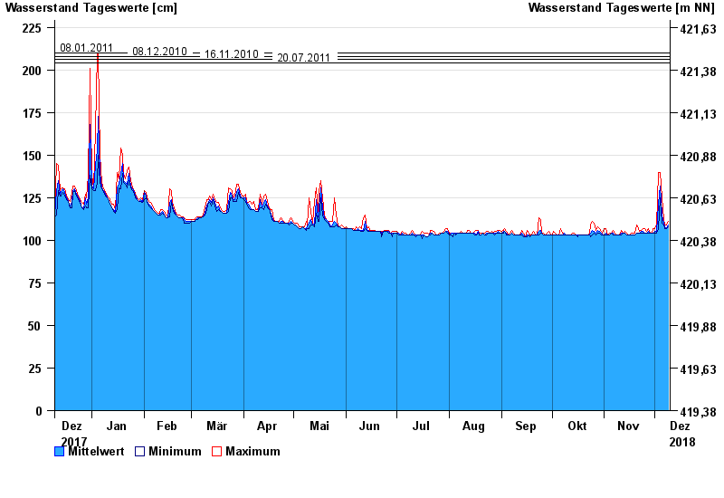
Chart of year Mitteldachstetten / Fränkische Rezat
Waterlevel from 10.12.2017 to 09.12.2018
- 31.05.2013 Wasserstand: 237 cm
- 08.01.2011 Wasserstand: 210 cm
- 08.12.2010 Wasserstand: 208 cm
- 16.11.2010 Wasserstand: 206 cm
- 20.07.2011 Wasserstand: 204 cm
| Date | Mean value [cm] | Maximum [cm] | Minimum [cm] |
|---|---|---|---|
| 09.12.2018 | 109 | 111 | 108 |
| 08.12.2018 | 107 | 109 | 107 |
| 07.12.2018 | 108 | 109 | 107 |
| 06.12.2018 | 110 | 112 | 109 |
| 05.12.2018 | 115 | 125 | 110 |
| 04.12.2018 | 132 | 140 | 125 |
| 03.12.2018 | 121 | 140 | 107 |
© Bayerisches Landesamt für Umwelt 2024