
- Start >
- Rivers >
- Waterlevel >
- Obere Donau >
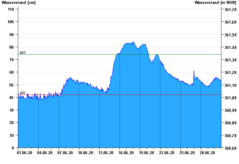
- Manching (Ort) >
- Chart of month

Chart of month Manching (Ort) / Paar
Waterlevel from 01.06.2020 to 30.06.2020
| Date | Waterlevel [cm] |
|---|---|
| 01.07.2020 00:45 | 52 |
| 01.07.2020 00:30 | 52 |
| 01.07.2020 00:15 | 52 |
| 01.07.2020 00:00 | 52 |
| 30.06.2020 23:45 | 53 |
| 30.06.2020 23:30 | 53 |
| 30.06.2020 23:15 | 53 |
© Bayerisches Landesamt für Umwelt 2024