
- Start >
- Rivers >
- Waterlevel >
- Obere Donau >
- Langengeisling >
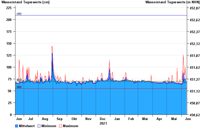
- Chart of year

Chart of year Langengeisling / Saubach
Waterlevel from 13.06.2021 to 12.06.2022
| Date | Mean value [cm] | Maximum [cm] | Minimum [cm] |
|---|---|---|---|
| 12.06.2022 | 67 | 74 | 66 |
| 11.06.2022 | 70 | 79 | 67 |
| 10.06.2022 | 76 | 90 | 68 |
| 09.06.2022 | 75 | 100 | 67 |
| 08.06.2022 | 73 | 83 | 67 |
| 07.06.2022 | 78 | 87 | 67 |
| 06.06.2022 | 89 | 110 | 76 |
© Bayerisches Landesamt für Umwelt 2024