
- Start >
- Rivers >
- Waterlevel >
- Obere Donau >
- Heroldingen >
- Chart of total period

Chart of total period Heroldingen / Wörnitz
Waterlevel from 06.02.1978 to 23.04.2024
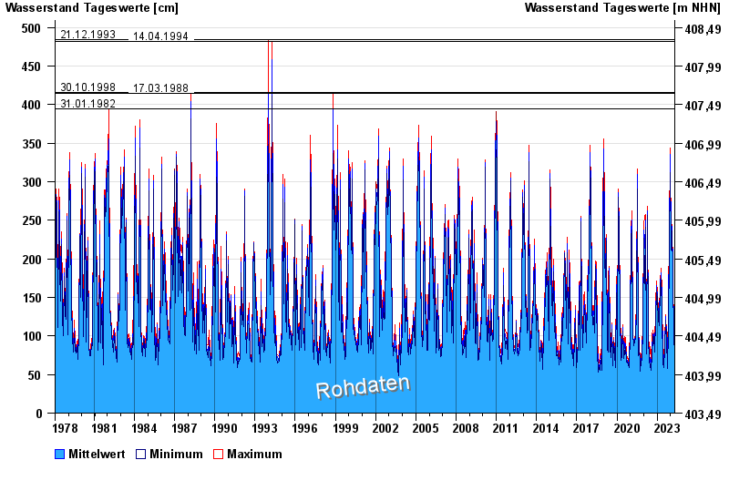
- 21.12.1993 Wasserstand: 484 cm
- 14.04.1994 Wasserstand: 482 cm
- 30.10.1998 Wasserstand: 416 cm
- 17.03.1988 Wasserstand: 415 cm
- 31.01.1982 Wasserstand: 395 cm
| Date | Mean value [cm] | Maximum [cm] | Minimum [cm] |
|---|---|---|---|
| 23.04.2024 | 85 | 85 | 84 |
| 22.04.2024 | 86 | 88 | 84 |
| 21.04.2024 | 83 | 88 | 78 |
| 20.04.2024 | 77 | 79 | 74 |
| 19.04.2024 | 72 | 75 | 68 |
| 18.04.2024 | 77 | 81 | 74 |
| 17.04.2024 | 79 | 83 | 73 |
© Bayerisches Landesamt für Umwelt 2024