
- Start >
- Rivers >
- Waterlevel >
- Obere Donau >
- Heroldingen >
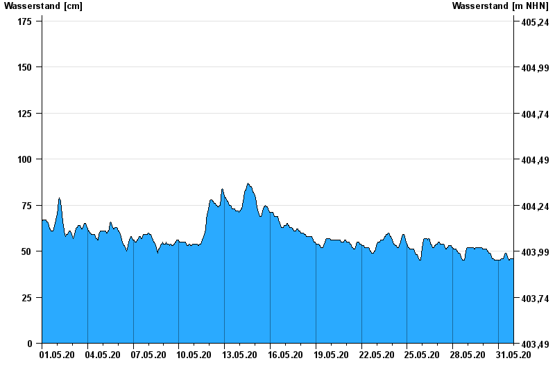
- Chart of month

Chart of month Heroldingen / Wörnitz
Waterlevel from 01.05.2020 to 31.05.2020
- 21.12.1993 Wasserstand: 484 cm
- 14.04.1994 Wasserstand: 482 cm
- 30.10.1998 Wasserstand: 416 cm
- 17.03.1988 Wasserstand: 415 cm
- 31.01.1982 Wasserstand: 395 cm
| Date | Waterlevel [cm] |
|---|---|
| 01.06.2020 00:45 | 46 |
| 01.06.2020 00:30 | 46 |
| 01.06.2020 00:15 | 46 |
| 01.06.2020 00:00 | 46 |
| 31.05.2020 23:45 | 46 |
| 31.05.2020 23:30 | 46 |
| 31.05.2020 23:15 | 46 |
© Bayerisches Landesamt für Umwelt 2024