
- Start >
- Rivers >
- Waterlevel >
- Obere Donau >
- Eichstätt >
- Chart of month

Chart of month Eichstätt / Altmühl
Waterlevel from 01.07.2021 to 31.07.2021
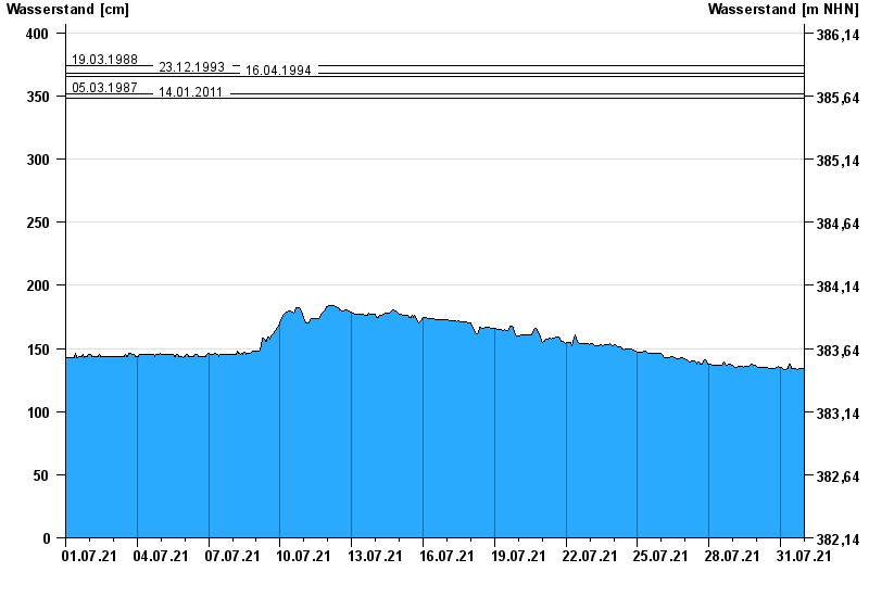
- 19.03.1988 Wasserstand: 374 cm
- 23.12.1993 Wasserstand: 368 cm
- 16.04.1994 Wasserstand: 366 cm
- 05.03.1987 Wasserstand: 352 cm
- 14.01.2011 Wasserstand: 348 cm
| Date | Waterlevel [cm] |
|---|---|
| 01.08.2021 00:45 | 134 |
| 01.08.2021 00:30 | 134 |
| 01.08.2021 00:15 | 134 |
| 01.08.2021 00:00 | 134 |
| 31.07.2021 23:45 | 134 |
| 31.07.2021 23:30 | 134 |
| 31.07.2021 23:15 | 134 |
© Bayerisches Landesamt für Umwelt 2024