
- Start >
- Rivers >
- Waterlevel >
- Obere Donau >
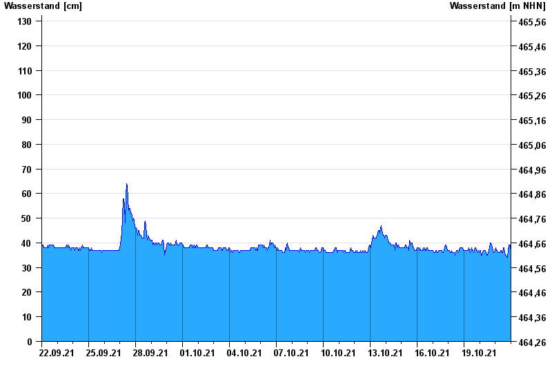
- Dasing >
- Chart of month

Chart of month Dasing / Paar
Waterlevel from 22.09.2021 to 21.10.2021
- 150 cm: Dasing: Überflutungsgefahr unterhalb von Dasing
- 229 cm: Dasing: Wasserstand beim Pfingsthochwasser 1999
- 230 cm: Dasing: Überflutungsgefahr im Ortsbereich
- 250 cm: Dasing: Unterkante der Paarbrücke (ehem. Bundesstraßenbrücke B 300) taucht ein
| Date | Waterlevel [cm] |
|---|---|
| 22.10.2021 00:45 | 35 |
| 22.10.2021 00:30 | 35 |
| 22.10.2021 00:15 | 35 |
| 22.10.2021 00:00 | 35 |
| 21.10.2021 23:45 | 36 |
| 21.10.2021 23:30 | 36 |
| 21.10.2021 23:15 | 37 |
© Bayerisches Landesamt für Umwelt 2024