
- Start >
- Rivers >
- Waterlevel >
- Obere Donau >
- Appolding >
- Chart of year

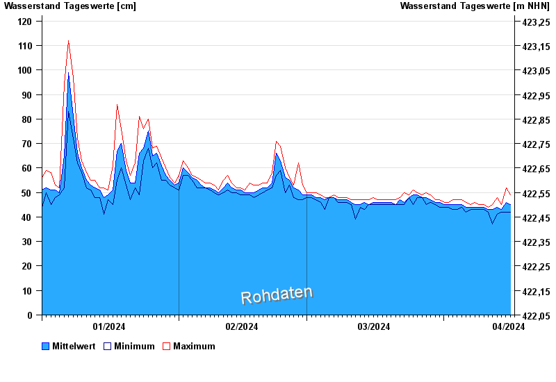
Chart of year Appolding / Strogen
Waterlevel from 01.01.2024 to 16.04.2024
- 09.06.1965 Wasserstand: 308 cm
- 01.06.1965 Wasserstand: 286 cm
- 03.06.2013 Wasserstand: 271 cm
- 02.08.1991 Wasserstand: 256 cm
- 15.02.1990 Wasserstand: 233 cm
| Date | Mean value [cm] | Maximum [cm] | Minimum [cm] |
|---|---|---|---|
| 16.04.2024 | 46 | 49 | 45 |
| 15.04.2024 | 46 | 52 | 42 |
| 14.04.2024 | 43 | 45 | 42 |
| 13.04.2024 | 44 | 48 | 41 |
| 12.04.2024 | 43 | 45 | 37 |
| 11.04.2024 | 43 | 44 | 42 |
| 10.04.2024 | 44 | 45 | 43 |
© Bayerisches Landesamt für Umwelt 2024