
- Start >
- Rivers >
- Waterlevel >
- Isar >
- Stein bei Altenmarkt >
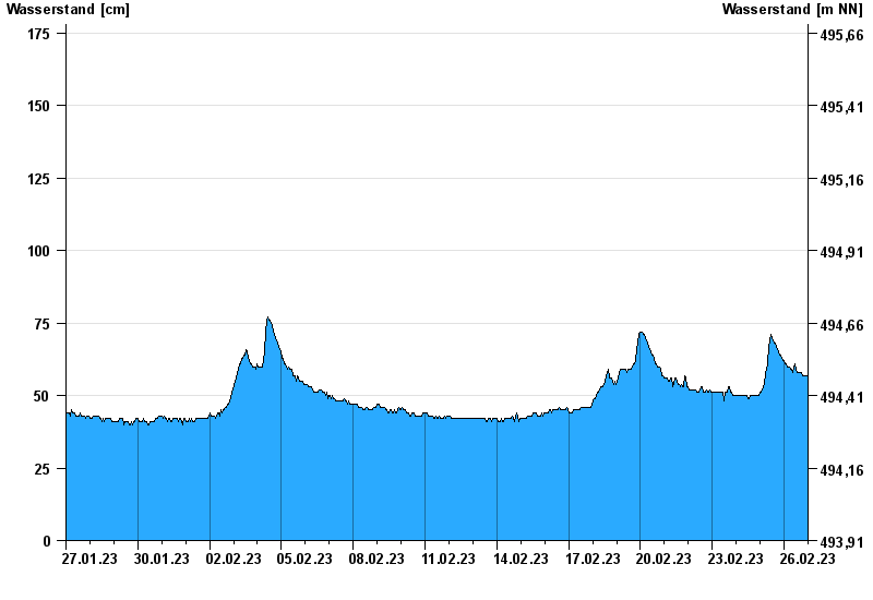
- Chart of month

Chart of month Stein bei Altenmarkt / Traun
Waterlevel from 27.01.2023 to 26.02.2023
- 12.08.2002 Wasserstand: 367 cm
- 02.06.2013 Wasserstand: 347 cm
- 26.06.1995 Wasserstand: 330 cm
- 01.08.1977 Wasserstand: 329 cm
- 20.07.1981 Wasserstand: 328 cm
| Date | Waterlevel [cm] |
|---|---|
| 26.02.2023 23:45 | 57 |
| 26.02.2023 23:30 | 56 |
| 26.02.2023 23:15 | 56 |
| 26.02.2023 23:00 | 56 |
| 26.02.2023 22:45 | 56 |
| 26.02.2023 22:30 | 57 |
| 26.02.2023 22:15 | 57 |
© Bayerisches Landesamt für Umwelt 2024