
- Start >
- Rivers >
- Waterlevel >
- Isar >
- Seebruck >
- Chart of year

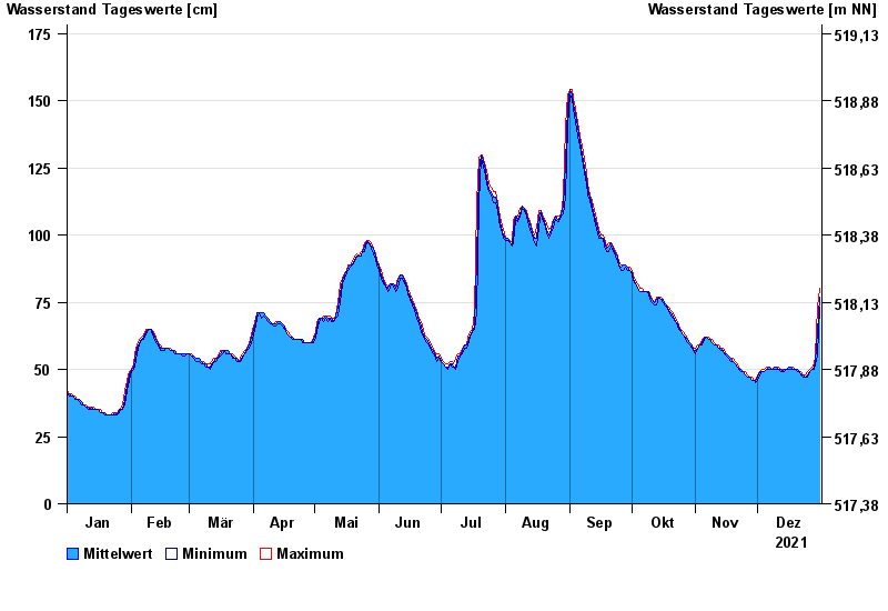
Chart of year Seebruck / Alz
Waterlevel from 01.01.2021 to 31.12.2021
- 03.06.2013 Wasserstand: 238 cm
- 04.08.1991 Wasserstand: 205 cm
- 22.07.1981 Wasserstand: 190 cm
- 13.08.2002 Wasserstand: 188 cm
- 12.09.2007 Wasserstand: 181 cm
| Date | Mean value [cm] | Maximum [cm] | Minimum [cm] |
|---|---|---|---|
| 31.12.2021 | 77 | 80 | 73 |
| 30.12.2021 | 64 | 73 | 55 |
| 29.12.2021 | 53 | 55 | 52 |
| 28.12.2021 | 51 | 52 | 50 |
| 27.12.2021 | 50 | 51 | 50 |
| 26.12.2021 | 49 | 50 | 49 |
| 25.12.2021 | 48 | 49 | 47 |
© Bayerisches Landesamt für Umwelt 2024