
- Start >
- Rivers >
- Waterlevel >
- Isar >
- Rottersdorf >
- Chart of month

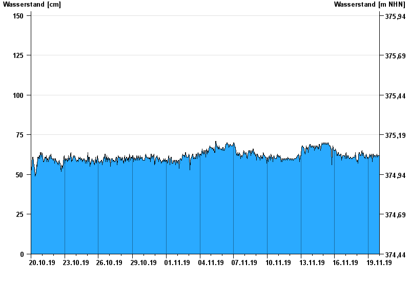
Chart of month Rottersdorf / Vils
Waterlevel from 20.10.2019 to 19.11.2019
- 03.06.2013 Wasserstand: 280 cm
- 21.02.1999 Wasserstand: 255 cm
- 04.08.1991 Wasserstand: 252 cm
- 31.03.2000 Wasserstand: 226 cm
- 14.04.1994 Wasserstand: 226 cm
| Date | Waterlevel [cm] |
|---|---|
| 19.11.2019 23:45 | 62 |
| 19.11.2019 23:30 | 62 |
| 19.11.2019 23:15 | 62 |
| 19.11.2019 23:00 | 62 |
| 19.11.2019 22:45 | 62 |
| 19.11.2019 22:30 | 62 |
| 19.11.2019 22:15 | 62 |
© Bayerisches Landesamt für Umwelt 2024