
- Start >
- Rivers >
- Waterlevel >
- Isar >
- Rosenheim u.d. Mangfallmündung >
- Chart of month

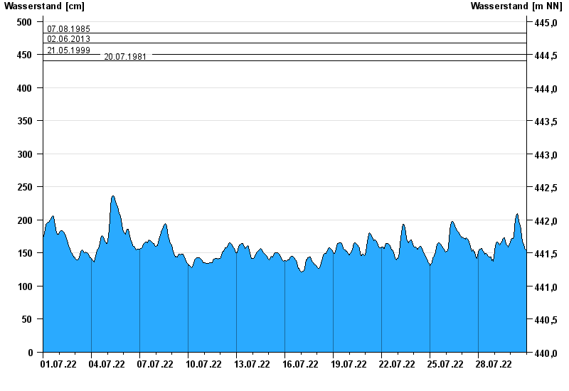
Chart of month Rosenheim u.d. Mangfallmündung / Inn
Waterlevel from 01.07.2022 to 30.07.2022
- 23.08.2005 Wasserstand: 511 cm
- 07.08.1985 Wasserstand: 483 cm
- 02.06.2013 Wasserstand: 468 cm
- 21.05.1999 Wasserstand: 451 cm
- 20.07.1981 Wasserstand: 441 cm
| Date | Waterlevel [cm] |
|---|---|
| 31.07.2022 00:45 | 149 |
| 31.07.2022 00:30 | 151 |
| 31.07.2022 00:15 | 152 |
| 31.07.2022 00:00 | 153 |
| 30.07.2022 23:45 | 153 |
| 30.07.2022 23:30 | 154 |
| 30.07.2022 23:15 | 154 |
© Bayerisches Landesamt für Umwelt 2024