
- Start >
- Rivers >
- Waterlevel >
- Isar >
- Rosenheim o.d. Mangfallmündung >
- Chart of month

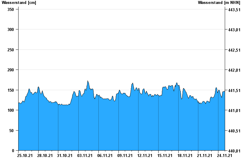
Chart of month Rosenheim o.d. Mangfallmündung / Inn
Waterlevel from 25.10.2021 to 24.11.2021
- 23.08.2005 Wasserstand: 568 cm
- 07.08.1985 Wasserstand: 551 cm
- 21.05.1999 Wasserstand: 522 cm
- 02.06.2013 Wasserstand: 511 cm
- 20.07.1981 Wasserstand: 493 cm
| Date | Waterlevel [cm] |
|---|---|
| 24.11.2021 23:45 | 148 |
| 24.11.2021 23:30 | 147 |
| 24.11.2021 23:15 | 147 |
| 24.11.2021 23:00 | 146 |
| 24.11.2021 22:45 | 146 |
| 24.11.2021 22:30 | 146 |
| 24.11.2021 22:15 | 146 |
© Bayerisches Landesamt für Umwelt 2024