
- Start >
- Rivers >
- Waterlevel >
- Isar >
- Reit im Winkl >
- Chart of year

Chart of year Reit im Winkl / Schwarzlofer
Waterlevel from 01.01.2021 to 31.12.2021
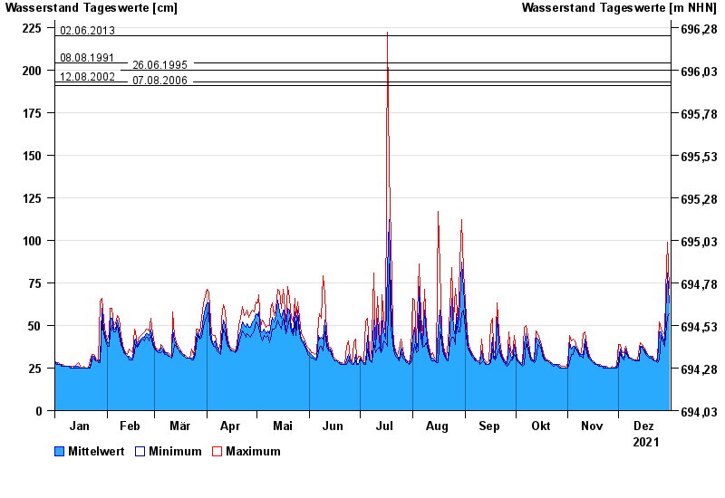
- 02.06.2013 Wasserstand: 220 cm
- 08.08.1991 Wasserstand: 204 cm
- 26.06.1995 Wasserstand: 200 cm
- 12.08.2002 Wasserstand: 193 cm
- 07.08.2006 Wasserstand: 191 cm
| Date | Mean value [cm] | Maximum [cm] | Minimum [cm] |
|---|---|---|---|
| 31.12.2021 | 63 | 72 | 57 |
| 30.12.2021 | 81 | 99 | 55 |
| 29.12.2021 | 57 | 70 | 44 |
| 28.12.2021 | 40 | 44 | 38 |
| 27.12.2021 | 43 | 46 | 41 |
| 26.12.2021 | 46 | 48 | 44 |
| 25.12.2021 | 46 | 52 | 30 |
© Bayerisches Landesamt für Umwelt 2024