
- Start >
- Rivers >
- Waterlevel >
- Isar >
- Reit im Winkl >
- Chart of year

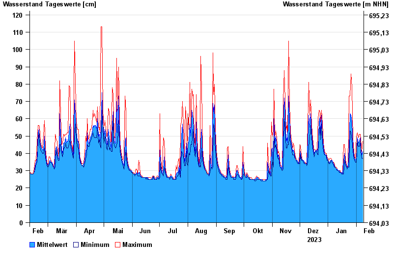
Chart of year Reit im Winkl / Schwarzlofer
Waterlevel from 09.02.2023 to 08.02.2024
| Date | Mean value [cm] | Maximum [cm] | Minimum [cm] |
|---|---|---|---|
| 08.02.2024 | 41 | 47 | 37 |
| 07.02.2024 | 39 | 41 | 37 |
| 06.02.2024 | 43 | 48 | 41 |
| 05.02.2024 | 49 | 51 | 47 |
| 04.02.2024 | 47 | 51 | 44 |
| 03.02.2024 | 46 | 49 | 44 |
| 02.02.2024 | 49 | 52 | 47 |
© Bayerisches Landesamt für Umwelt 2024