
- Start >
- Rivers >
- Waterlevel >
- Isar >
- Raisting >
- Chart of year

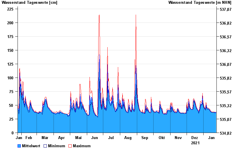
Chart of year Raisting / Rott
Waterlevel from 25.01.2021 to 24.01.2022
- 21.05.1999 Wasserstand: 321 cm
- 18.06.1986 Wasserstand: 314 cm
- 17.06.1979 Wasserstand: 310 cm
- 07.11.1979 Wasserstand: 301 cm
- 08.08.1978 Wasserstand: 293 cm
| Date | Mean value [cm] | Maximum [cm] | Minimum [cm] |
|---|---|---|---|
| 24.01.2022 | 37 | 38 | 36 |
| 23.01.2022 | 37 | 37 | 36 |
| 22.01.2022 | 37 | 37 | 36 |
| 21.01.2022 | 37 | 38 | 36 |
| 20.01.2022 | 37 | 38 | 37 |
| 19.01.2022 | 37 | 38 | 37 |
| 18.01.2022 | 37 | 38 | 37 |
© Bayerisches Landesamt für Umwelt 2024